W
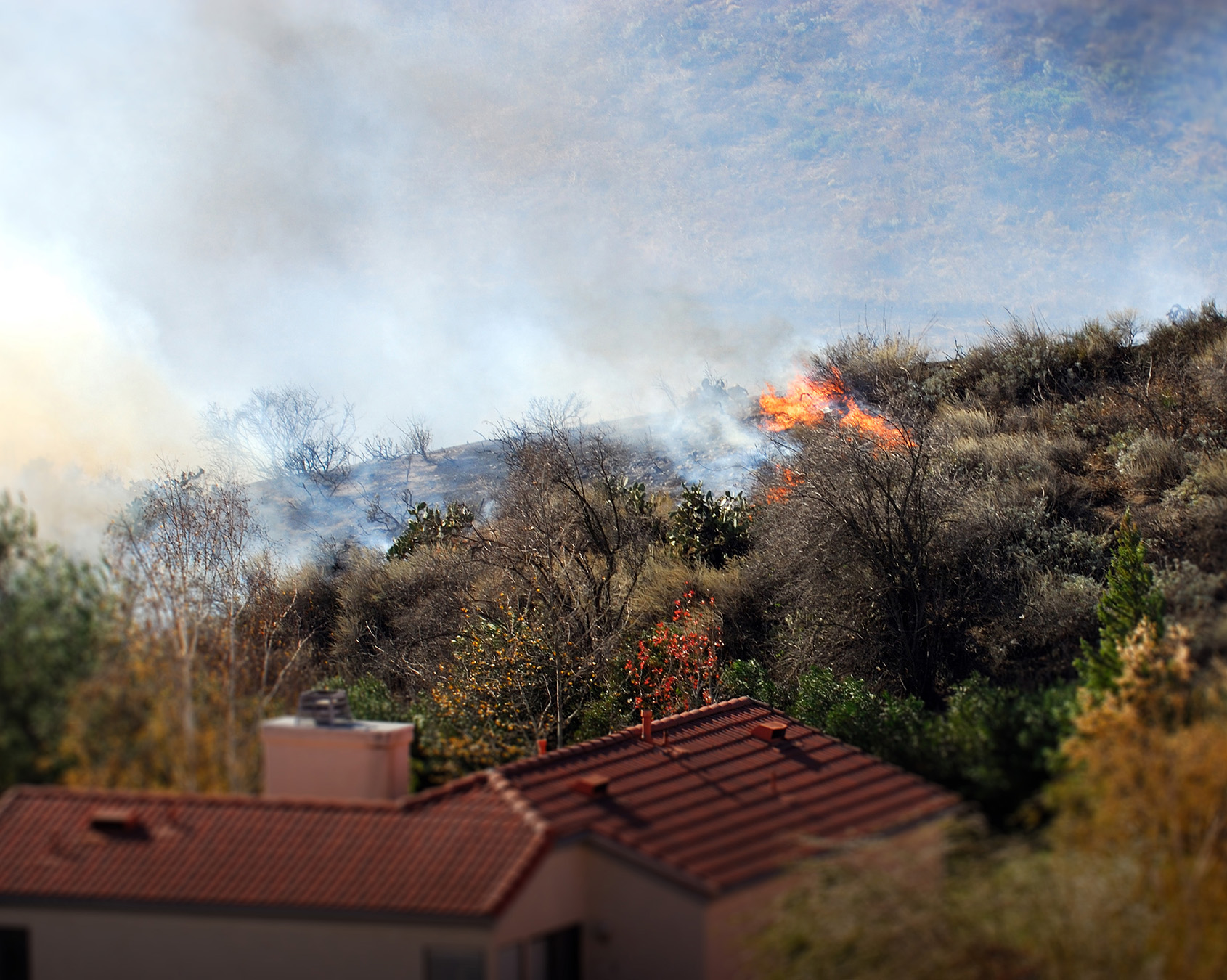
ildfires have caused property damage in California for decades, with an increase in frequency and severity since the late 2010s. This is partly due to an increase in residential use of areas considered high-risk fire zones. Insurance availability does not seem to help much in preserving home values in high-risk areas.
Historical data from California's state fire agency, CAL FIRE, shows that over 300,000 fire episodes occurred in the state between 1987 and 2022. The number of structures destroyed by fires increased from about 355 yearly on average in the 1990s to an annual average of about 4,055 in the 2010s. This increase is partly due to a series of especially damaging fires in 2017 and 2018 and partly to an increase in residential use of areas deemed as high fire-risk zones.
The increases in severity, structure damage, and residential use of areas with high fire risk suggest that wildfire risk could negatively affect the residential real estate market in California, particularly as the state continues to struggle with a shortage of available housing units.
Wildfires and residential areas in recent decades
Figure 1 shows wildfire activity in California from 1984 through 2021. It shows the number of wildfires and the average acreage burned per fire for wildfires exceeding 1,000 acres. The figure shows that while the number of wildfires each year does not follow any particular trend over time, the area burned by wildfires has increased substantially, particularly in recent years.
Wildfire risk and housing values
The increasing intensity of wildfires and the growing exposure to high-risk areas have implications for real estate markets in California. We examine this issue using data from different sources. We use wildfire data from the Monitoring Trends in Burn Severity (MTBS) database of 1,000-plus acre fires, particularly information about each fire’s burn perimeter and ignition date, to measure past fire activity. Housing market data come from annual parcel-level administrative tax records obtained through CoreLogic. These data contain information on each property’s value, characteristics such as lot and building size, and location including zip code. We focus on single-family owner-occupied homes and analyze annual data at the zip code level. To measure wildfire risk, we identify the five wildfires closest to each zip code in each year, calculate the distances between the zip code and these five wildfire burn perimeters, and take an average. We use the geographic center of each zip code to calculate distances to the fire perimeters.
We estimate the relationship between distance from past wildfires and residential real estate values, controlling for other factors that can help explain variation in home values over time and across zip codes. These factors include property characteristics such as lot size, building square footage, and other property amenities. Importantly, we also account for trends over time by including average home values within a zip code rather than comparisons across zip codes. We omit zip codes with geographic centers within about 3 miles (5 kilometers) of fire perimeters to avoid using data on homes that may have been destroyed by fire. Finally, we estimate this relationship for wildfires that happened in the current year, the year before, two years before, and three years before to examine how a previous fire may affect values today. For brevity, here we focus on the effects of wildfires that happened three years before, since those patterns are similar to the patterns from earlier past fires.
Figure 2 reports the estimated relationship between the average distance in hundreds of miles to the zip code’s five closest wildfires and the average home values in the zip code. The blue dot shows the results using the first part of our sample, from 2008 to 2017. The green dot reports results for the most recent period, from 2018 to 2021. The red dot will be discussed in a later section. The bars around each data point show the statistical significance within a 95% confidence range. The positive values indicate that homes farther from past fires tend to have higher property values. Comparing the two results shows that the estimated relationship between distance from fire zones and home values was stronger in the more recent sample. While the change is notable, the effects are relatively small. Even in the late sample, being farther from past fires is associated with a boost in home value of about 2% for homes of average value.
This change in patterns roughly aligns with the increasing wildfire intensity in California. The recent large fires may have changed homeowners’ perceptions of fire risk, which could alter how they view the tradeoff between amenities associated with living in risky areas and potential damages from wildfires (Donovan, Champ, and Butry 2007).
Using our estimates, we calculate the cumulative average effect of wildfire activity in 2021 and the three years prior on home values in each zip code. This calculation takes into account how far each zip code was from the closest five fires in 2021, 2020, 2019, and 2018. Figure 3 shows these estimates relative to the statewide average—that is, the difference between the estimated cumulative effect for each zip code and the average cumulative effect in the state. Data are not available for areas shown in white.
The figure shows wide variation across zip codes. In particular, coastal regions in central and northern California and arid desert regions in the extreme south experienced benefits relative to the average from wildfires. In contrast, in vegetated and mountainous areas around Los Angeles and in the Sierras, wildfires lowered home values relative to the average, as these areas were closer to where wildfires burned.
Does insurance help home values?
Since our results indicate that wildfire risk may lower home values, we assess whether homeowner’s insurance can counterbalance this risk.
Homeowners can obtain insurance through the private market or through the state-created California FAIR plan. The latter option is an alternative for homeowners who are not able to obtain insurance in the private market—an insurance in the state-created FAIR plan is an alternative to obtain insurance market—an alternative to obtain insurance—an alternative to obtain insurance—an alternative to obtain insurance—an alternative to obtainance—an alternative to obtainance—an alternative to obtainance—an alternative to obtainance—an alternative to obtainance—an alternative to obtainance—an alternative to obtainance—an alternative to alternative to obtainance—an alternative to obtainance—an alternative to obtainance—an alternative to alternative to alternative to obtainance—an alternative to alternative to alternative to alternative to alternative to alternative to alternative to alternative to alternative to alternative to alternative to alternative to alternative to alternative to alternative to alternative to alternative to alternative to alternative to alternative to alternative to alternative to alternative to alternative to alternative to alternative to alternative to alternative to alternative toalternative toalternative toalternative toalternative toalternative toalternative toalternative toalternative toalternative toalternative toalternative toalternative toalternative toalternative to alternative to alternative toalternative toalternative toalternative toalternative toalternative toalternative toalternative toalternative to alternative toalternative toalternative to alternative toalternic toalternic to alternative toalternic to alternative toalternic to alternative to alternative toalternic toalternic toalternic toalternic toalternic toalternic to alternative to alternative to alternative to alternative to alternative to alternative toalternic to alternative to alternative to alternative to alternative to alternative to alternative to alternative to alternative to alternative to alternative to alternative toalternic to alternative to alternative to alternative to alternative to alternative to alternative to alternative to alternative to alternative to alternative to alternative to be more to alternative to alternative to alternative to alternative to alternative to be more to alternative to alternative to alternative to alternative to alternative to alternative to alternative to alternative to alternative to alternative to alternative to alternative to alternative to alternative to alternative to alternative to alternative to alternative to alternative to alternative to alternative to alternative to alternative to alternative to alternative to alternative to alternative to alternative to the threat increterically.
to the current to the past year to the past the past year to the least the
to the
the other to the previous to the